


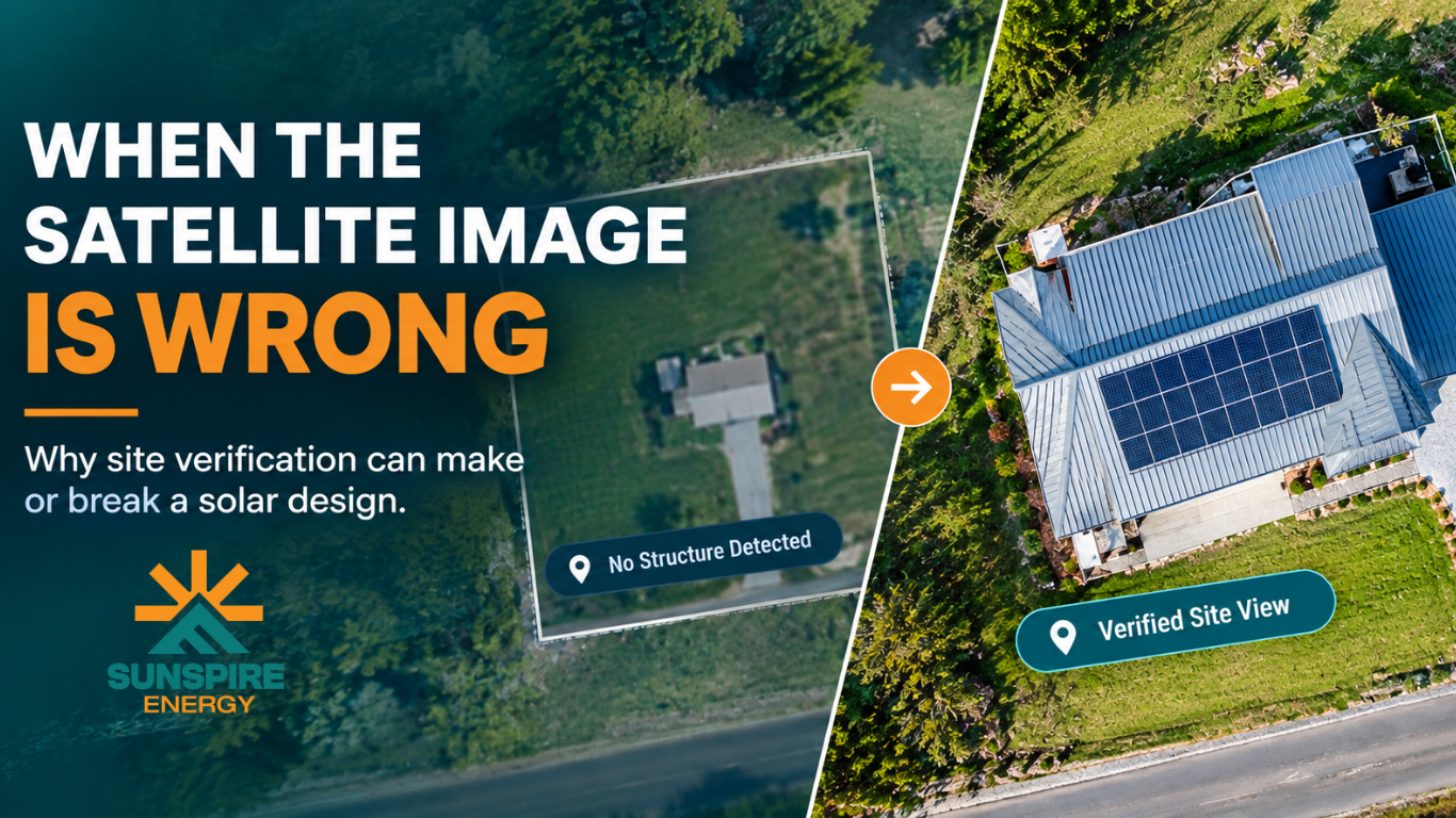
The Roof That Wasn’t on the Map: How Engineering Verification Caught What the Data Missed
A Solar Site Verification Case Study
In solar design, the information provided with a project is only the starting point.
Measurements, site photos, satellite imagery, and project notes all help an engineer understand the property. But when those sources don’t tell the same story, the right response isn’t to make an assumption and move forward.
It’s to stop, verify, and find out what is actually there.
That is exactly what happened on a residential solar project in Kansas.
The homeowner had extended the roof, but the change was not known to the installer. The available photos and mapping imagery did not clearly show the extension either. However, the submitted measurements indicated additional roof area.
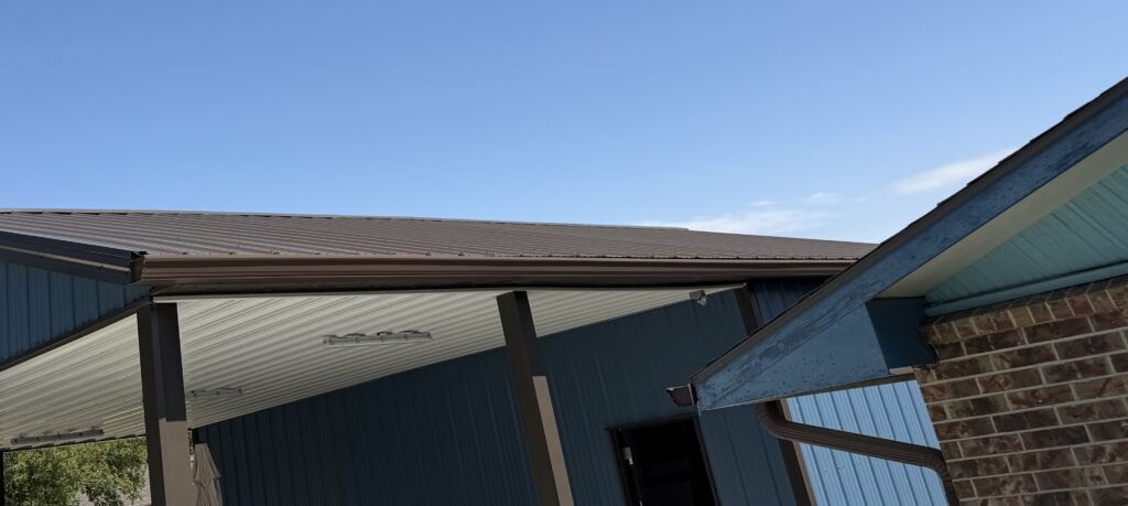
During engineering review, those details did not align.
Instead of treating the measurement as sufficient or relying on the available imagery, the engineering team flagged the discrepancy and requested a current top-view drone image from the installer.
That additional verification revealed the current roof condition and gave the engineering team the information needed to move forward with the design.
The lesson is simple: good solar engineering doesn’t just use the information provided. It checks whether the information agrees.
1. The Project Looked Straightforward
At first, this appeared to be a routine residential solar design.
The project documentation included the information needed to begin the engineering process, including site measurements, site survey details, project photos, and mapping information.
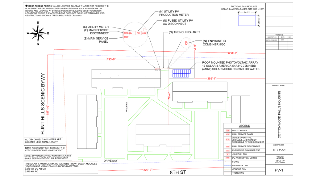
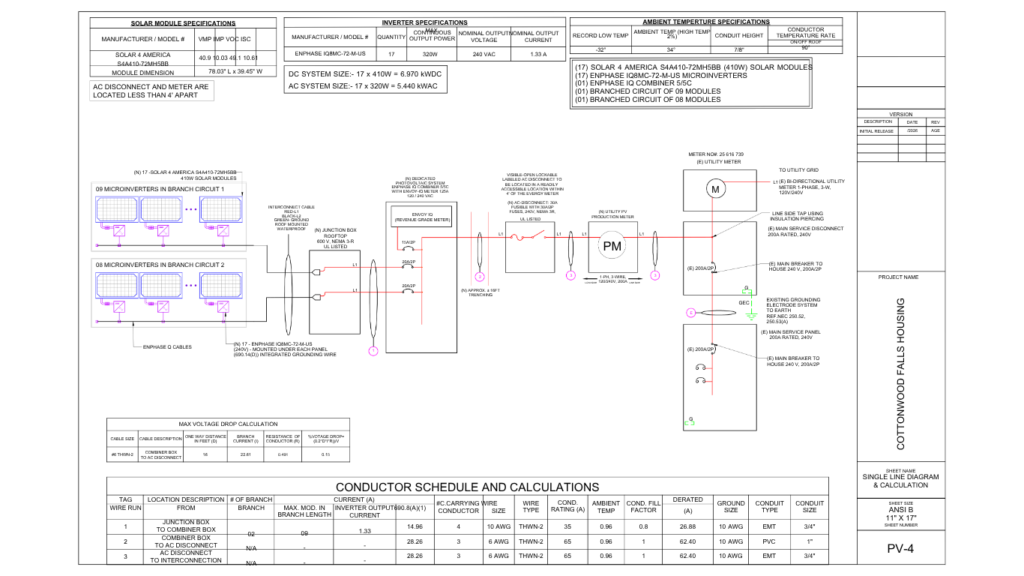
The proposed system consisted of 17 roof-mounted solar modules, with a system size of approximately 6.97 kW DC and 5.44 kW AC.
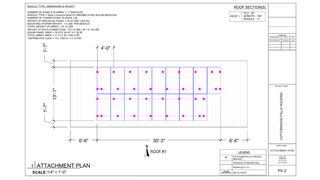
The final plan set also identified a metal roof and a roof-mounted attachment system using Pegasus Standard Rail with S-5! Protea Brackets.
Everything seemed ready for design.
But the engineering review is where another question appeared:
Did the available information actually represent the current roof?
2. The Homeowner Had Changed the Roof
The important detail was not a mistake by the installer.
The homeowner had extended the roof.
The installer did not know about the change when the project was submitted, so there was no reason for the installer to intentionally provide incomplete information.
This is an important distinction.
Construction and property modifications can happen between the time information is captured and the time a solar project reaches engineering.
A roof can be modified. An addition can be completed. A structure can be built. And mapping imagery may not reflect those changes immediately.
That means an engineer cannot always assume that one source of information represents the current site condition.
3. Why Didn’t the Measurements Match the Visual Evidence?
The submitted measurements indicated an extended roof area.
But when the engineering team began cross-checking the project information, they couldn’t clearly verify that extension in the available visual information.
The roof extension was not apparent in the photos provided. It also wasn’t visible in the available mapping imagery.
That created a discrepancy:
The measurements suggested one condition. The visual evidence suggested another.
This is exactly the type of situation where an engineering review matters. The question wasn’t:
“Which piece of information is wrong?”
The better question was:
“What does the current site actually look like?”
4. The Engineer Didn’t Guess
There were several ways the project could have been handled. The engineer could have:
- designed from the measurements alone,
- assumed the existing imagery was current,
- ignored the difference,
- or continued with an unverified roof condition.
Instead, Abhishek Vasant Sonawane, Senior Engineer at Sunspire Energy, flagged the discrepancy. A current top-view drone image was requested from the installer so the roof could be visually verified.
That additional information provided a much clearer representation of the actual roof condition. From flagging the issue to finalizing a verified, submission-ready design, the entire re-verification process was completed in under 6 hours.
The engineering process changed from assumption to verification — without slowing the project down.
5. From Site Verification to Solar Design
Once the current roof condition could be verified, the engineering team could proceed with the design using a better understanding of the site.
The final plan set reflects a roof-mounted PV system with:
- 17 solar modules
- 6.970 kW DC system size
- 5.440 kW AC system size
- Metal roof
- Pegasus Standard Rail
- S-5! Protea Brackets
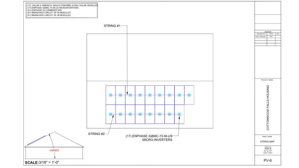
- Enphase IQ8MC-72-M-US microinverters
The site plan also documents the PV array, electrical equipment, trenching, service equipment, and utility-related components for the project — the same level of documentation applied to every project regardless of size.
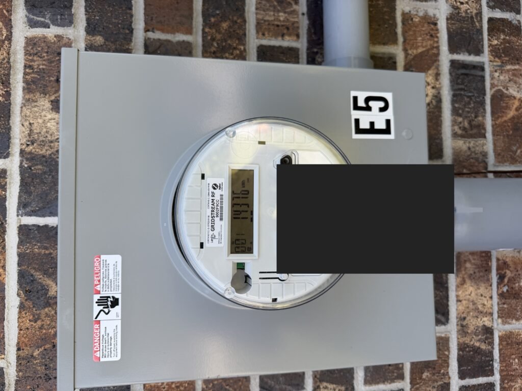
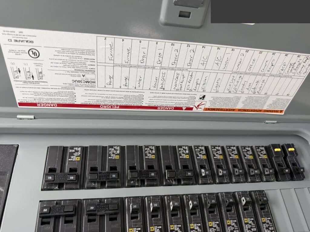
The point isn’t that the project was difficult because of its system size. The important part was what happened before the design was finalized.
The engineering team identified that the available information did not fully agree and obtained the additional site evidence needed to resolve the discrepancy.
6. Why Satellite Imagery Is Useful — But Not the Final Source of Truth
Satellite and mapping imagery are extremely useful during solar design. They help engineers understand:
- property orientation,
- surrounding structures,
- roof positioning,
- site access,
- nearby obstructions,
- and the general layout of a property.
But mapping data has a limitation: it represents a captured point in time.
A recently modified roof may not appear in the imagery yet. That doesn’t necessarily mean the imagery is “bad.” It means the physical site can change faster than the available mapping data is updated.
That’s why professional solar design should use mapping imagery as one input among several, rather than treating it as an unquestionable representation of the current site.
7. The Real Engineering Check: Do the Sources Agree?
A strong engineering review isn’t simply a process of transferring measurements into CAD. It’s a process of checking whether the available information makes sense together.
For a solar project, an engineer may need to compare:
Measurements
↓
Site Photos
↓
Mapping / Satellite Imagery
↓
Equipment & Project Information
↓
Current Site Evidence
When those sources agree, the design process can move forward with greater confidence. When they don’t, that’s when the engineer needs to investigate.
In this case, the discrepancy between the measurement and visual information triggered exactly that additional check.
8. What This Means for Solar Installers
For installers, this kind of engineering verification can be especially valuable because the installer may not always know about every physical change at a property.
A homeowner may modify a roof. A new structure may be added. A roof section may be extended. Construction may happen after the original imagery was captured.
The installer can provide everything they have and still have an incomplete picture of the current site.
That’s why the engineering partner’s job shouldn’t simply be:
“We received the files, so we’ll design from the files.”
It should be:
“We received the files. Now let’s verify that they make sense together.”
That difference matters.
9. Fast Doesn’t Mean Rushed
There is also an important lesson about turnaround time.
A fast engineering workflow does not mean skipping verification. In fact, identifying a discrepancy early can help prevent a much bigger problem later.
Catching an inconsistency during design is generally far easier than discovering it after:
- a permit submission,
- an AHJ correction,
- a revision request,
- an installation issue,
- or a field mismatch.
The objective isn’t simply to produce a drawing quickly. The objective is to produce a design that is based on the best available project information — and on this project, that meant resolving the discrepancy and delivering a verified design in under 6 hours.
Fast should mean efficient — not careless.
10. The Bigger Lesson: Verify Before You Finalize
This Kansas project demonstrates something that applies far beyond one roof.
Solar projects are built on information. If the information is incomplete, outdated, or inconsistent, the design process needs a mechanism to catch that.
The engineer’s role is not just to draw what the inputs appear to say. It’s to question the inputs when they don’t agree.
In this case:
The measurements showed an extended roof.
The photos didn’t clearly show it.
The available mapping didn’t show it either.
The engineer flagged the discrepancy.
A current drone view was requested.
The site was verified.
The design moved forward.
That is what engineering review is supposed to do.
“We Don’t Guess. We Verify.”
A solar design can only be as reliable as the site information behind it. But when different sources disagree, guessing is not an engineering strategy. Verification is.
This case is a good reminder that site verification doesn’t necessarily mean more complexity. Sometimes it means asking one additional question before the design moves forward.
And that one question can prevent much bigger problems later.

Project Snapshot
| Project Type | Residential rooftop solar |
|---|---|
| Location | Kansas, USA |
| Roof Type | Metal roof |
| PV Modules | 17 |
| System Size | 6.970 kW DC |
| AC System Size | 5.440 kW AC |
| Inverters | Enphase IQ8MC-72-M-US microinverters |
| Mounting | Pegasus Standard Rail + S-5! Protea Bracket |
| Key Engineering Issue | Current roof condition did not align with available visual information |
| Verification Method | Current top-view drone imagery provided by installer |
| Turnaround | Under 6 hours — discrepancy flagged to submission-ready design |
| Senior Engineer | Senior Engineer Abhishek Vasant Sonawane |
What Solar Installers Can Take Away From This
Before a solar design moves forward, ask:
1. Do the site survey measurements match the photos?
If not, investigate before designing.
2. Does the roof visible in the imagery match the submitted dimensions?
If the answer is unclear, don’t assume.
3. Could the property have changed since the imagery was captured?
Recent construction or roof modifications can create discrepancies.
4. Is there enough current visual evidence to design confidently?
If not, request better site information.
5. Has the engineering team actually cross-checked the inputs?
Receiving information and verifying information are two different things.
Frequently Asked Questions
Can satellite imagery be used for solar design?Yes. Satellite and mapping imagery can be valuable for understanding the general property and roof layout. However, it should be treated as one source of information because imagery may not reflect recent construction or property modifications.
What happens if measurements don’t match satellite imagery?The discrepancy should be investigated rather than automatically choosing one source. Additional photos, measurements, site survey information, or current aerial/drone imagery may be needed to verify the actual site condition.
Why is site verification important for solar permit design?Permit-ready solar designs depend on accurate information about the existing property, roof, equipment, structural conditions, and electrical configuration. Verifying inconsistencies early can help reduce avoidable revisions and design issues later in the process.
Can a homeowner’s roof modification affect a solar design?Yes. A roof extension, addition, or other modification can change available roof area, array placement, attachment locations, setbacks, and other design considerations.
What should an installer do if they aren’t sure whether the roof has changed?Provide the engineering team with the most current information available. If the available photos, measurements, and mapping don’t agree, current site imagery or another form of site verification may help resolve the discrepancy.
Does fast solar design mean skipping verification?No. A fast workflow should improve efficiency without removing engineering checks. On this project, the engineering team verified a roof discrepancy and finalized the design in under 6 hours — identifying discrepancies early is part of an efficient design process, not a shortcut around it.
Need a Second Set of Engineering Eyes on Your Solar Projects?
When project information doesn’t line up, you shouldn’t have to guess.
Sunspire Energy supports U.S. solar installers with PV design, engineering review, permit-ready plan sets, PE stamping, revisions, and related solar permitting services.
Have a project that needs engineering review?
Talk to Our Engineering Team →
Because your permit shouldn’t depend on a guess.

